Tuesday, June 28, 2016

Trip to Svalbard

Travelling to Svalbard
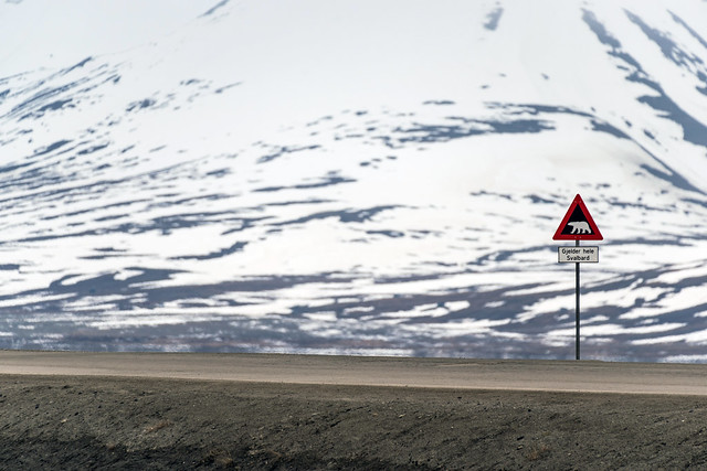
Polar bear sign in Longyearbyen, Svalbard
Polar bear danger sign
Checking on the map, Svalbard seems like a far-away isolated and probably impossible-to-reach destination. The truth is that is no more difficult accessible than any other town in Norway, perhaps a bit further away. There are daily flights, either from Oslo or Tromso in Norway, both by SAS and Norwegian. If you are looking for a good price, book your tickets long in advance. On Longyearbyen there is a number of hotels and hostels, and the prices vary.
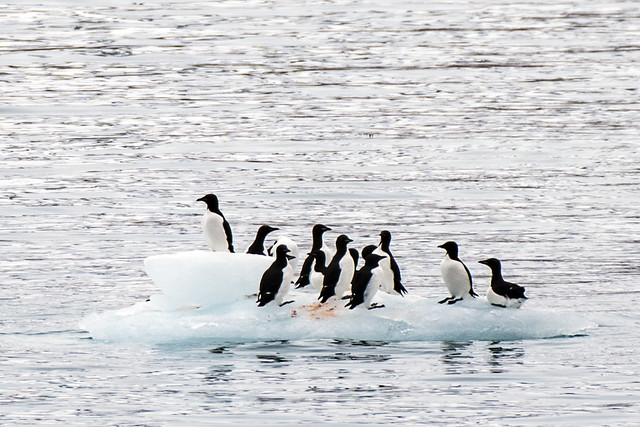
Brünnich’s guillemots in Svalbard
Brünnich’s guillemots
Once there, it is best to plan some activities. Depending on the season, the island is a mecca for outdoor activities lovers. There is possibility of multi day hiking (provided all necessary permits have been obtained, including the riffle one), dog sledge (both on snow and on wheels!), kayaking, cruise, climbing, ice caving, hiking, bus tour.... It all depends on the time, the adventure level, the budget and of course the time of the year. The main portal where all activities on offer can be found is Visit Svalbard

A bit of history
The Svalbard archipelago was discovered by the Dutch in 1596. Trying to find a passage to the East via the North Pole, the explorer Willem Barentsz, made a few attempts as he believed during the summer months, the ice cap would melt completely. He soon realized that this was not the case but he kept coming back and during the 3rd expedition, in 1596, he discovered the Spitsbergen island.
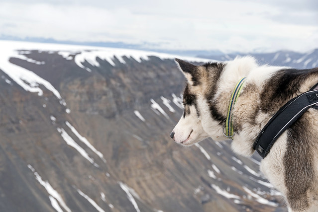
Greenland husky in Svalbard
Greenland husky
The following centuries, Europeans travelled to Svalbard for its rich natural resources. At a time when lamps were running on whale oil, whale hunting was a very profitable business. The Europeans managed to almost completely wipe the local whale population and the number still have not recovered. Along with whales, foxes, walruses, seals and of course polar bears attracted hunters.

In the late 19th century large coal deposits were discovered on the island. Americans, Norwegians, Swedes and Dutch quickly set up colonies to extract the precious mineral. After only a few years, only Norwegians and Russians were left on the island as the rest found it difficult and expensive to continue business.
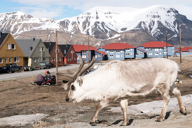
Unexpected visitor in Longyearbyen, Svalbard
Reindeer in Longyearbyen
After WWI, along with the treaty of Versailles, the treaty of Svalbard was signed (1920). It recognized sovereignty of Norway over Svalbard but any of the countries that signed could (and still can) set up a settlement on any of the islands. The only country that ever did, apart form Norway, is the Soviet Union.

During WWII all the settlements were evacuated so they would not be captured by the Germans. A small Norwegian garrison stayed behind and in 1943 the Germans managed to capture it. Longyearbyen and the Soviet town of Barentsburg were destroyed.

With the beginning of the Cold war started, the Norwegians and Soviets returned to the archipelago. It was now more a matter of prestige than a real economical necessity to have settlements on the Svalbard. Coal was being produced (and still is) and the two communities lived in harmony together.
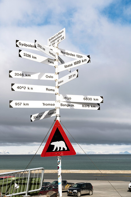
Welcome sign at the Longyearbyen airport
Sign in Longyearbyen airport
In terms of transportation, until 1975 Svalbard was only accessible by boat and only in the summer months. The last boat with provisions, Christmas trees etc would come to Longyearbyen in November and the next one only in in April. The coalminers in Longyearbyen would live in isolation during the cold winter months. The airport opened in 1975 which changed completely the life of the locals. For the first time they could get fresh food!

Nowadays, with much of the coal either depleted or financially not viable, the Norwegians are trying to diversify the economy. Tourism and scientific research are two important and growing sectors. There are several meteorological and space observation stations with permanent staff. Russians, also not wanting to give up their part on the island, still extract coal in the town of Barentsburg but have left all their other settlements.
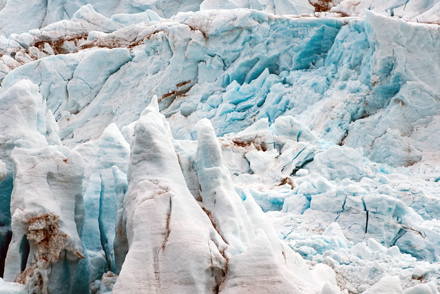
Nordenskjöld glacier, Spitsbergen
Nordenskjöld glacier
Svalbard of Spitsbergen?
Svalbard in the name of the archipelago that consists of several islands, Spitsbergen being the largest one. The size of the whole archipelago is around 61000sqkm, similar to the size of Sri Lanka. For many years the name Spitsbergen was used but after the Svalbard treaty the Norwegians changed the name to Svalbard.

Longyearbyen
"The town where no one is born and no one is allowed to die"

Yes, this is right! In the largest town of Svalbard, no one is being born because the hospital is not well enough equipped, so pregnant women are flown to the mainland. Also, no one can die there because they cannot be buried (the permafrost makes decomposition a very difficult process). In reality, unless one has a job in Longyearbyen, they are not allowed to stay on the island. So as much as someone would love to stay and enjoy their pension there, they cannot!
The colorful houses of the miners in Longyearbyen, Svalbard
Longyearbyen colorful houses

With a permanent population of over 2000, beautiful colored buildings and constant presence of tourists, the city is vibrant and welcoming. There are a handful of well equipped stores and a super market which sells most of the stuff (including fruits and vegetables) that I find in my local super market in Amsterdam! The local restaurants serve excellent food (even at 1:30am which is hard to find proper food at this time in Amsterdam!) and the prices are generally lower than Oslo because there is no VAT. Also alcohol is much cheaper. In Radisson Blue, Barents restaurant I had one of the best pizzas I have ever tried (either it was very good or I was extremely hungry!).
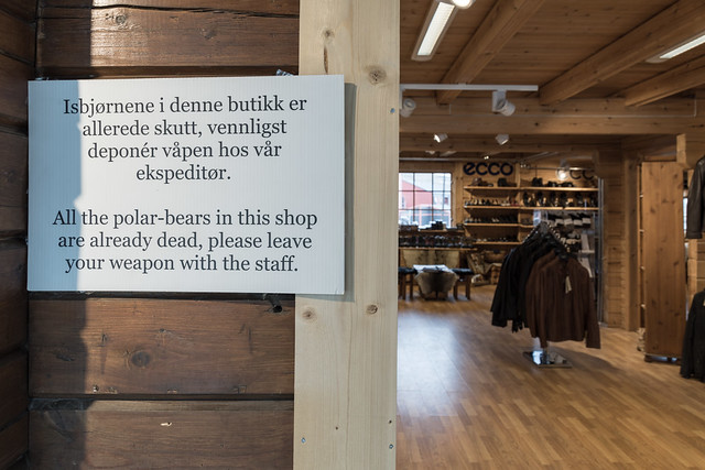
Store sign in Longyearbyen, Svalbard
Sign in Longyearbyen store

Although a bit hilly, the city can be visited entirely on foot. It is spread out but it is well worth visiting every "neighborhood". The local tourist office (located opposite Hotel Svalbard) offers bikes for rent. Because of the polar bear, they can be used only within the city limits.


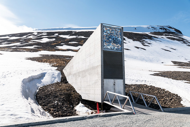
The Global Seed Vault
Global seed vault
Around 3km away from Longyearbyen, the Global seed vault is located. Although, just outside the city, it is a nice ride to visit by bike or even on foot. There is no way to enter the seed vault but the exterior is still a nice attraction, considering the good purpose it serves. There is no permanent staff, no guard so it is just the entrance you see in the pics. Still it is well worth the visit.

Other things to do in Longyearbyen is to visit the local cinema (Yes there is one!), one of the cafés offering delicious pastries, the Svalbard museum and stroll around to see if you can spot the reindeer that frequently roams the city.

Pyramiden
Abandoned town of Pyremiden in Svalbard
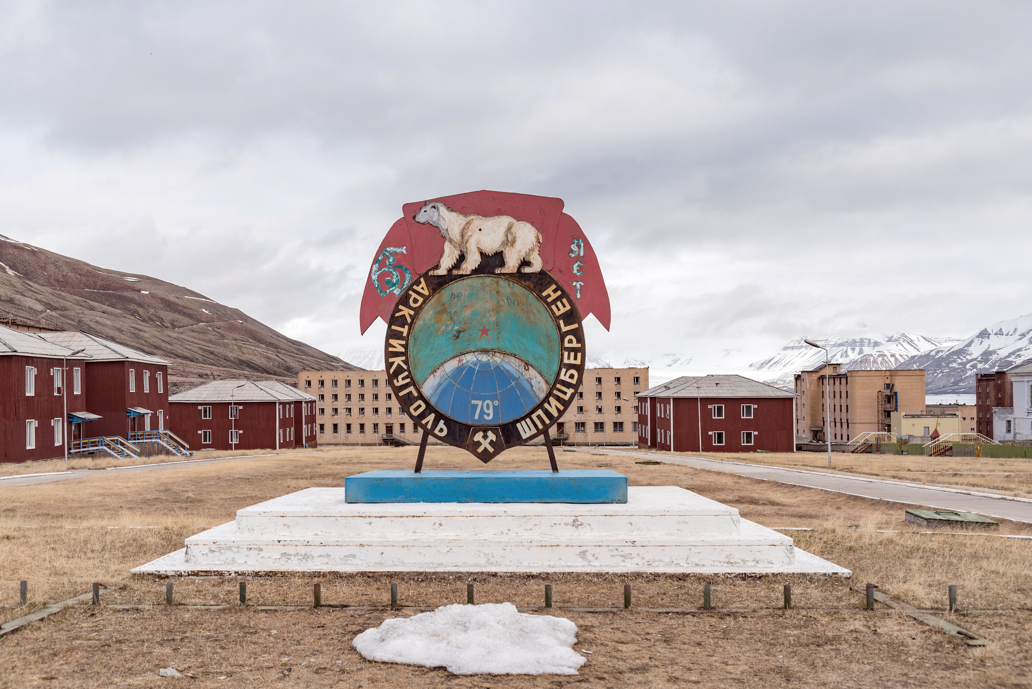
Artikugol sign
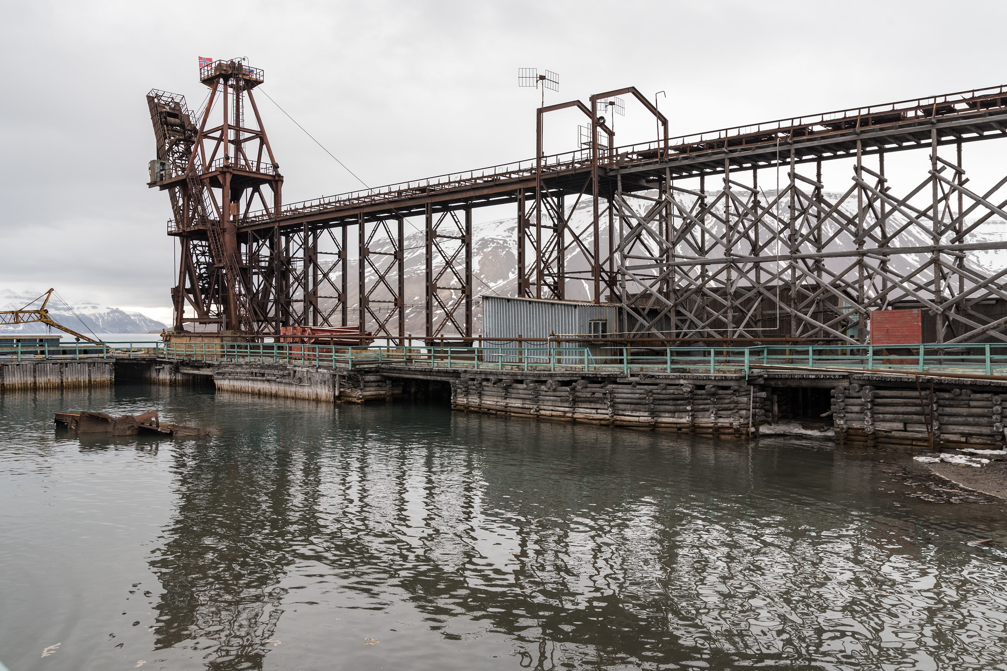
On the island of Spitsbergen and in the Billefjorden, lies the ghost town of Pyramiden (Piramida in Russian). It was founded by Sweden in 1910 and sold to the Soviet Union in 1927. Until 1998 it produced coal, and on March 31 of that year the last wagon of coal left the mine and now lies at the entrance of the  city. All the workers and their families quickly left Pyramiden, leaving the buildings and their interior largely intact.

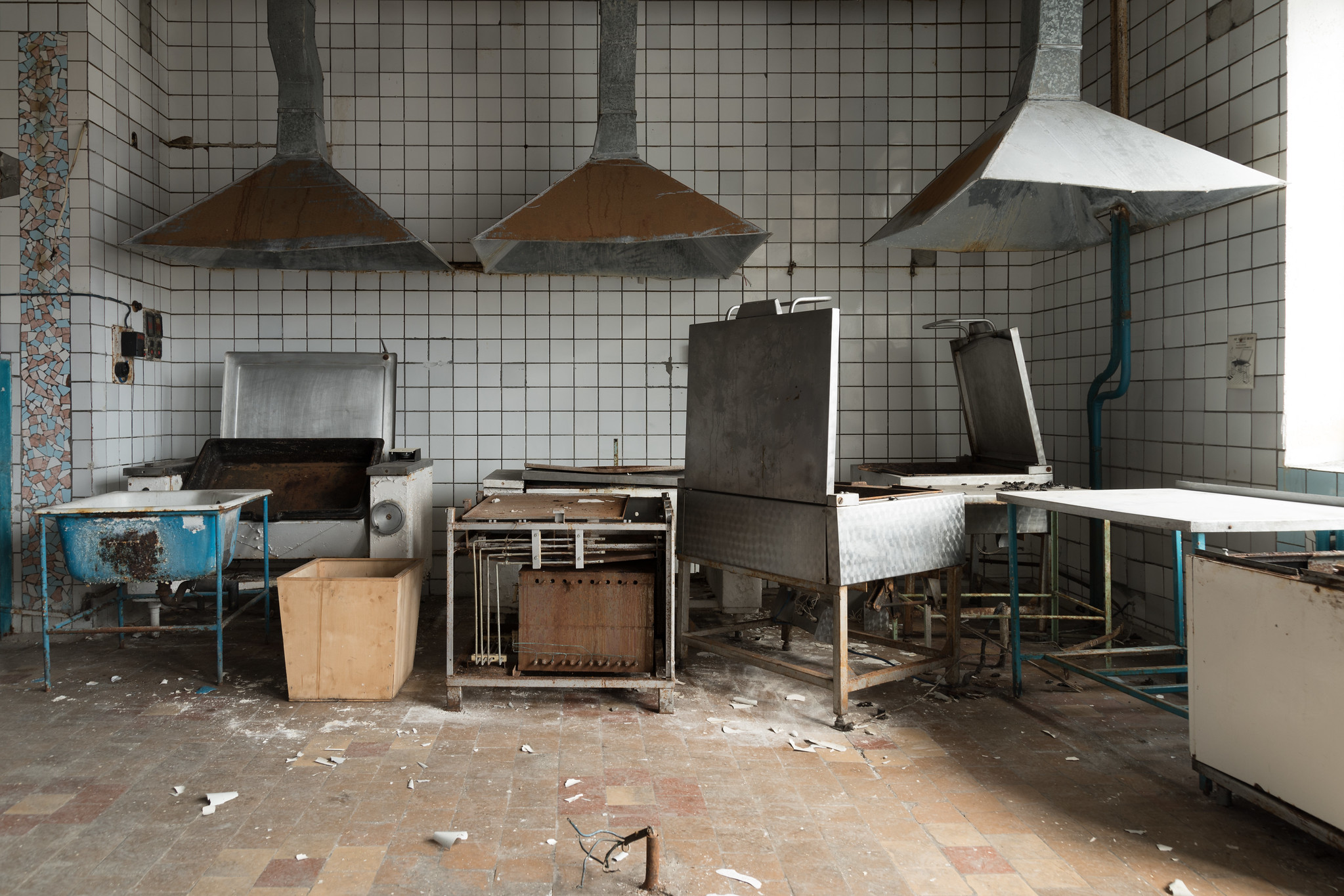
The common dinning area
Abandoned kitchen
Currently there are 8 Russians in Pyramiden who take care of whatever is left and run the hotel, the restaurant and the bar. In its glorious days, Pyramiden had around 1000 citizens. The life of those 8 is quite hard, considering the harsh environmental conditions (up to -20 in the winter and absolutely no sun) but also the fact that there is no internet, no telephone and no TV. Once a month, a helicopter comes from Longyearbyen, brining post and other goods from Russia. Cant help thinking how isolated those guys are but then I though it would be nice to detox from internet, social media and all the other beeps and blips of modern era.

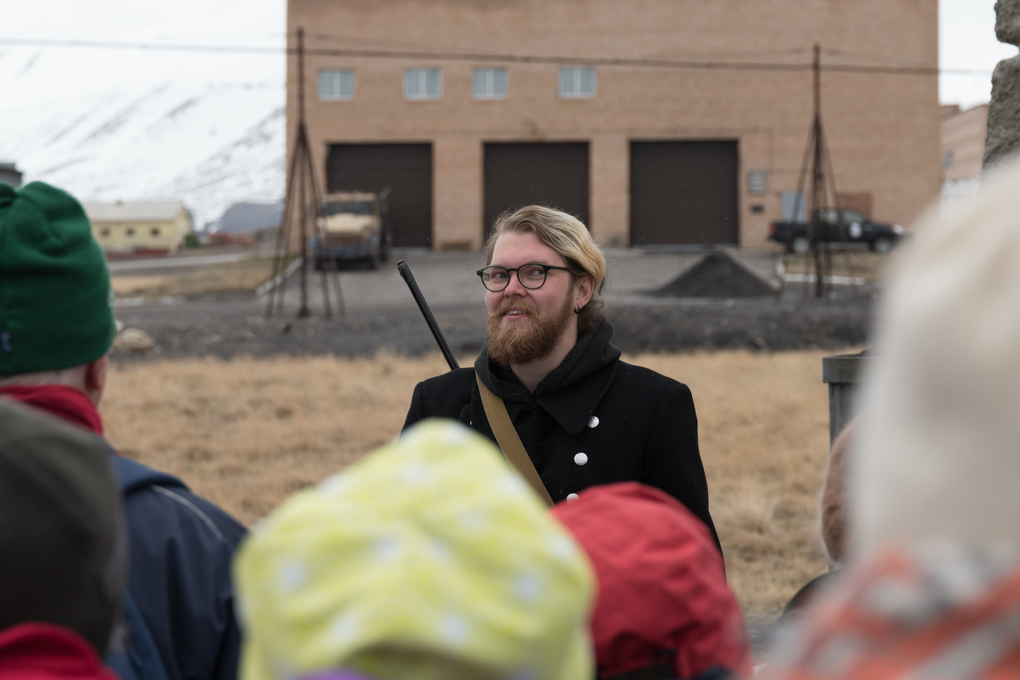
Our guide, one of the 8 citizens
Our guide with his gun
Slightly northern than Longyearbyen, Pyramiden is the world 's northernmost city. Despite that, the Soviets managed to create a place where it did not lack much of the rest of the Soviet Union at the time. The workers could enjoy a well equipped cinema and a library, a swimming pool, sports hall a hospital and even an animal farm which produced meat and fresh eggs!


The port of Pyramiden
Pyramiden harbor
Pyramiden is accessible by boat and snow scooter from Pyramiden. Since we visited in the summer, the only way to get there is by boat. Upon arriving on the port, a friendly and fully armed (for the polar bear) local guide showed us around the town, allowing us to enter a few of the abandoned buildings. At the end of the tour we had a chance to visit the bar/restaurant and try some delicious Russian sweets made by the cook who lives on Pyramiden for 9 years (!).

More pictures?
You can visit my flickr page on www.flickr.com/gpahas

Sunday, September 14, 2014

Weekend in Luxembourg

Luxembourg town
Luxembourg is a tiny landlocked country squeezed between Belgium, Germany and France. Its name lends to the Lux part of the term Benelux (the other 2 being Belgium, Netherlands). It has a population of something more than 500.000 and measures 80km north to south.

Having been to the capital (its also called Luxembourg) 2 times in the past I simply adore the Grand Duchy so decided to visit for a weekend to explore it a bit further. It's an easy 4hr drive from Amsterdam.

Streets of Diekirch
This time our visit started from the town of Diekirch where our hotel was located. Luxembourg has the lowest fuel prices in the EU and clever as they are, the first thing that the visitor notices (if entering the country driving) is the plethora of gas stations immediately when entering the country! In the fall of 2014, euro 95 gas costs 1.8 in the Netherlands, 1.5 in Belgium and 1.3 in Luxembourg. I guess everyone living right next to the borders fill in their cars only in Luxembourg.

Diekirch is famous for its local brewery which produces a beer with the same name and a war museum. The city itself is very beautiful and what makes a big impression is that on the streets we heard almost exclusively ...Portuguese! Apparently Luxembourg's population is almost 16% Portuguese who arrived long time ago to work on the mines, at the south of the country.

Alzette river, Luxembourg
Our plan was to spend one day in the city of Luxembourg which we did on Saturday. We left the car on a P+R and we took the bus for a 10min ride. The city of Luxembourg is small but impressive. The old part of it is built in a canyon but since then has expanded and the nearby hills are also built. One can still visit the impressive fortifications. To the east of the city the skyscrapers of what is mostly EU institutions stand out. The wealth of this tiny nation is visible everywhere from the impressive and clean streets to the constructions and buildings. There is even an elevator to get to the old town level (called the Grund). The city is vibrant and beautiful and its worth spending time exploring it. I feel the pictures say more than my words will ever will :-)


Esch sur Sure castle
Esche sur Sure
The following day we visited the more quiet village of Esch-sur-Sure (population 314!). It stand amid forests and rivers and it is almost completely encircled by the river Sauer. It makes an excellent base for a number of hikes in the area and this is what we did. The paths are clean and very clearly marked, making it extremely difficult to get lost. The one we followed took us next to the lake Lac de la Haute-Sure. The view was simply spectacular! After a few hours of walk, full of beautiful images of forests, lakes and corn fields, we returned to the village for a nice meal into one of the many restaurants. We decided to go for local specialties, like Judd mat Gaardebounen (easier eaten than pronounced!) and Gromperekichelcher which we washed down with some nice Grand Cru beer. Well fed and rested, the hidden treasures of Esch-sur-Sure awaited us! A must visit are the castle ruins that dominate the hill top. With little effort we climbed to the ruins and enjoyed the majestic view.

The weekend was soon over and we started to drive to the Dutch capital. With a little help from the sunny and warm weather, this was an amazing weekend and Luxembourg certainly will stay in our hearts till the next time...

Thank you for reading this one too..
Colorful houses in Diekirch


The gorges. Adolphe Bridge

The Human trash exhibition

Luxembourg

Alzette river, Luxembourg

Orchestra

Colorful streets of Luxembourg

The Grund, Luxemboug

Bridge in Luxembourg city

Lac de la Haute-Sure

Castle ruins
 

Tuesday, September 2, 2014

Visiting Samos, the island of Pythagoras


Blue and green waters
This summer, after quite a few years I decided to visit the island of Samos. It is located on the Aegean Sea, close to the Turkish coast (actually the closest point is 1.6km straight line).

The island is unique and much different than the rest of the famous Greek islands of Cyclades as it is covered with forests and has waterfalls and vineyards on the sides of its two mountains, Kerkis and Karvounis. Easily accessible by boat and plane from Athens and Thessaloniki but also with direct flights from many European cities during the whole summer.


Ano Vathi
The base of our exploration was Samos town. Not the most historic town of the island, still beautiful, rich with history and the capital. The city has been historically split into 2 different large neighborhoods, the village of Ano Vathi and Samos town. Ano Vathi retains its beautiful architecture, village atmosphere with narrow alleys and traditional architecture. Built on a hill it requires good fitness level to climb from the sea level but certainly the visitor is rewarded by the magic view and traditional architecture. If not fit enough there are roads to reach the top by car or taxi. The church of Ai-Giannakis is a good spot, especially in the sunset.


Gagou beach
The rest of the town is built around the port and is where the market, the bars and cafes are located. In the area behind the old Xenia hotel (an abandoned building that one cannot miss) lies a beautiful square, the city hall and the archeological museum where the largest Kouros that has been found in Greece is on display. It's certainly worth a visit. Near the port there is a row of beautiful bars built on large balconies of old mansions right on the sea. After a long day on the beach it worth visiting for a refreshing cocktail or even better a glass of local sweet wine (vin doux)!


Add caption
Near Vathi there are only a couple of beaches accessible on foot, the best one being Gagou, a small bay fully organized with umbrellas, sun beads etc. This year we encountered a pleasant surprise, a seal (monachus monachus) that was sitting among bathers! On the eastern side of the island there is a seal colony but apparently this lonely, young one left the herd and found comfort among people. The locals gave her a name – Argyro- and in the summer of 2014 it visited several of the busy beaches of the island. Next to Argyro, almost always, members of the Greek organization “Archipelagos” sat making sure that curious visitors did not come too close to her, fed it and bothered it. Hopefully she will find her way to the rest of her herd.


Manolates village
Pigi Pnaka
Samos is a big island with bad public transportation (that's true for most of Greece) which makes renting a car a necessity. We did so and started by visiting the villages, Manolates and Vourliotes. Built on high altitude they offer unparalleled views of the Aegean Sea and unique architecture, cobbled stone alleys and taverns lying below vineyards. On the village of Manolates many artists produce and sell their work. You can even see art on the making! Although both villages offer excellent taverns, my recommendation is a very special one built right next to a spring called "Pigi Pnaka". On the way to Vourliotes there is a sign on the main road some 2km before the village. Follow it and it leads to a quiet place, under a huge platanus and next to a spring. The view is breathtaking. As of 2014 it is run by two very friendly Greek guys who cook excellent local food. Don't miss the staffed pumpkin flower and the local chickpea-balls which you can wash down with some souma, a spirit produced on the island.

Good beaches (but way too touristic for my taste) in the proximity of the above mentioned villages are Tsabou and Tsamadou. It seems that few locals ever visit any of those but if you have seen pictures of Samos beaches, the chance is that it is one of those two.

One of the reasons Tsamadou beach is so popular, is that is it lies within walking distance from Kokkari, one of the two main touristic places of the island (the other one being Pythagorion). Whatever you have in mind as a touristic stereotype you will find it there: Greek traditional music and tourists dancing around it, colorful drinks with little umbrellas, plethora of hotels, etc. Nice place and definitely worth visiting both day and night.

Kokkari by night..

Most loved by foreigners on the island is the village of Pythagorion, on the south-east side of the island. Full with taverns, cafes, bars, hotels, souvenir stores and right next to the airport it offers a convenient base to explore the island. Unique are the taverns that offer food right on the beach. Cannot comment on the food as I have never sat there but please leave a comment if you have!


Vourliotes main square
Definitely worth visiting close to Pythagoreion are the Tunnel of Eupalinos and the monastery of Panagia Spiliani (literally: Virigin Mary of the cave). The tunnel of Eupalinos is an ancient aqueduct built through the mountain in order to bring water to the ancient city of Pythagoreion from the other side of the island. The main accomplishment is that construction began on both sides of the mountain and engineers met somewhere in the middle only a few meters apart. Must have been an amazing engineering achievement at the time! The monastery of Virgin Mary of the cave is a nice Greek Orthodox monastery built next to a natural cave in which a tiny church is built.


Statue of Pythagoras
Second biggest town of the island, is Karlovassi on the western side. A modern place with a few University departments is more of a student town than a tourist destination. Still worth visiting and best combined with the Potami beach a few km to the west. Before you dive to the sea, make sure you visit the waterfalls that are located right behind the beach. Bear in mind that even in the warmest summer day, the water on the waterfalls will be freezing cold. When entering the small valley there are a number of waterfalls leading all the way up to the mountain (the visitor can climb few first of them). Few years ago there used to be ropes leading from the 1st to the 2nd, the 2nd to the 3rd etc. In the summer of 2014, those were gone so it makes it pretty tough to climb and that's why most visitors will just see the first one.

With no road access, a few km to the west from Potami beach lies Megalo Seitani, a beach where the monk seals reproduce (and that is probably why access to the beach is difficult). Definitely worth a visit both for the beach and the hike.

One of my favorite villages and rather isolated, is that of Platanos. Few km away from Karlovassi (still on the western side) and in high altitude offers unique view and a number of good taverns.


Poseidonion with Turkey in the background
Finally, I could not leave out my favorite beach on the island, Kerveli. I remember we used to go there when I was a kid and there was nothing but a single house and a military post. Now hotels are taverns have been built making it a lot noisier. Still, the few trees offer shadow under which one can always put their towel and there are no umbrellas and sunbeds. A short drive away is the village of Poseidonion, which is the closest point to Turkey with also lovely waters and a couple of taverns.

 For the more adventurous


Church bell of Panagia Spiliani monastery
The unique, mountainous, topography of the island offers the chance to engage in alternative activities like hiking, mountain biking and cycling. Most of the paths are well maintained and signed. A few I can recommend as I have completed myself:


  • Stavrinides - Manolates (or the opposite): A rather easy hike around 3km
  • Agios Kostantinos - Vourliotes: Starting from sea level and reaching 350m after 6km it requires some level of fitness for the way up. Still a beautiful hike crossing  creeks and almost always walking under the shadow of the trees
  • Pandroso - Top of Karvounis Mountain: A rather difficult hike as the path is not clean and is extremely steep at points. For the fit enough, it will take you from this beautiful village to the top of the second tallest mountain, where a church and a couple of strange constructions lie. Getting down is a lot easier
  • Drakaioi - Megalo Seitani: Beautiful hike, will take you from the most remote village on the island to the beach where the seals reproduce. Long but not difficult hike. It’s easy going and slightly more difficult coming back as the village is up on the mountain


Sunset in Aegean Sea
Popular with locals and foreigners is cycling. A good tour is starting from Pythagorion, moving westwards towards Karlovassi, from there on the north side all the way to Vathi and back to Pythagorion. During the summer make sure you start early as it can get pretty warm quickly.


Thank you for reading!


Church of Ai-Giannakis in Ano Vathi

White church
 
Tavern in Manolates
Kerveli beach


Church in Poseidonion
Samos town city hall


Dining on the beach
Pythaogoreion

Touristic Pythagoreion


Vourliotes